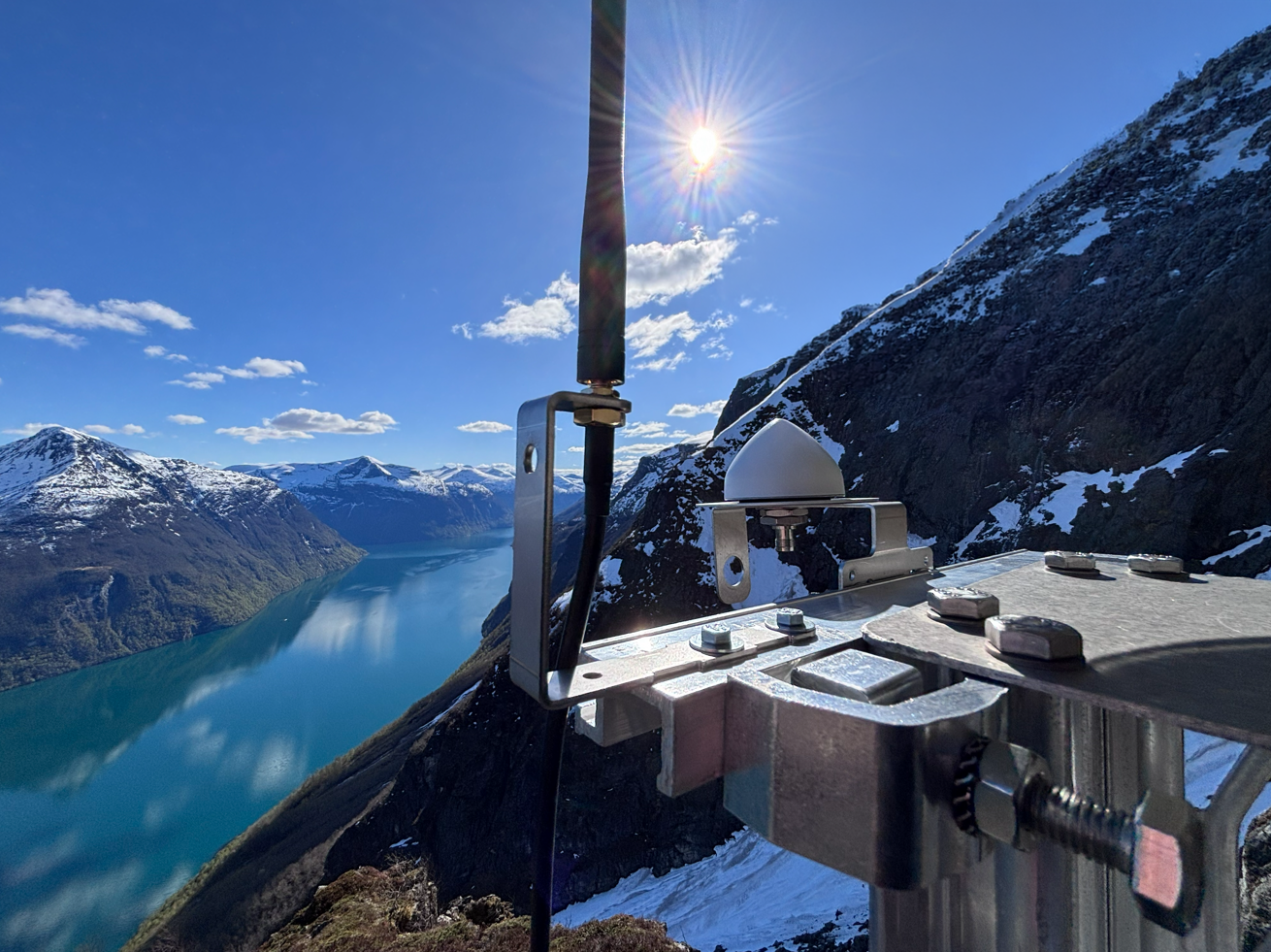
The Norwegian Water Resources and Energy Directorate (NVE) has started a new test project at the Geirangerfjord, and is now strengthening monitoring of the area using a Worldsensing GNSS sensor supplied by Geonor.
Installing advanced monitoring technology on steep, unstable mountain slopes presents both practical and technical challenges. At the same time, access to accurate, real-time data is essential for understanding terrain movements. With a stunning view of the Norwegian landscape, this installation is positioned to provide a solid data base for both avalanche prevention and early warning.
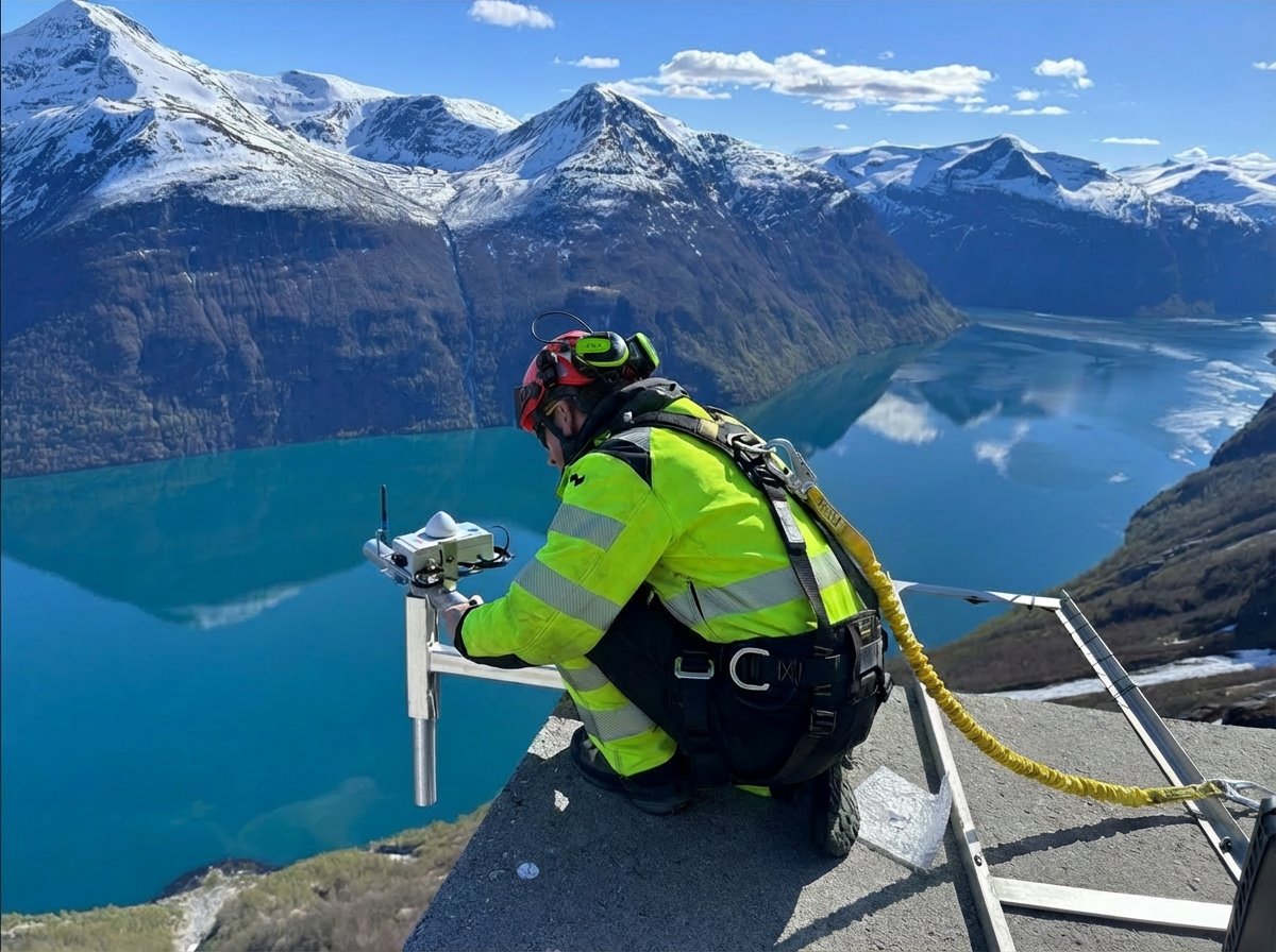
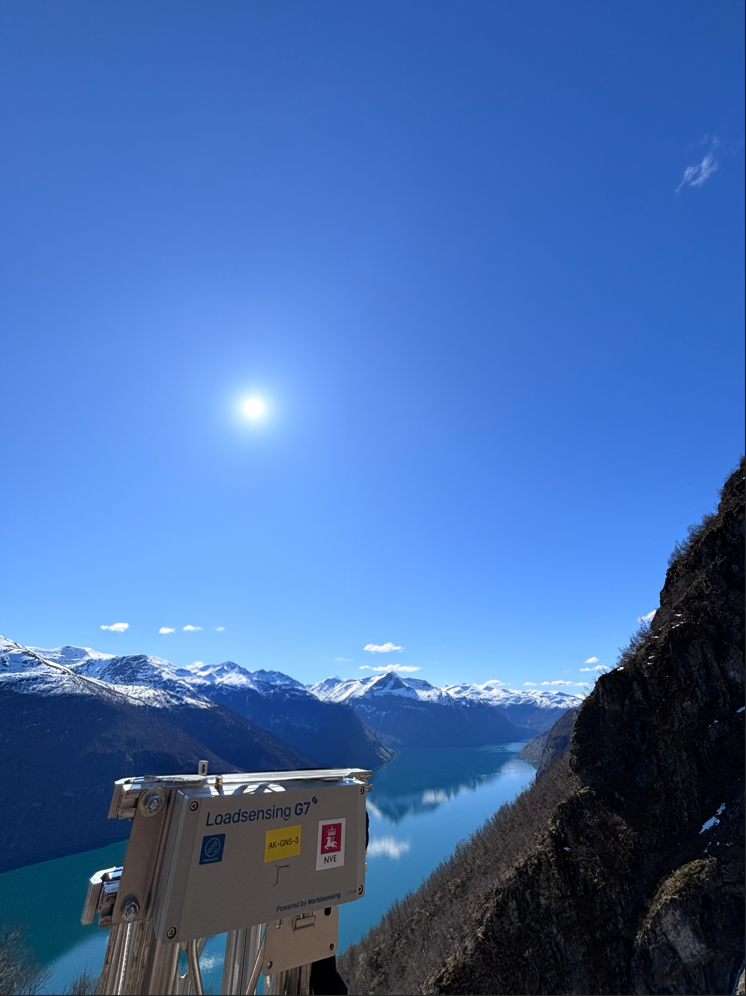
Unlike traditional monitoring that often requires physical visits to the field, the GNSS sensor is designed for automated, continuous data collection. The sensor is a Worldsensing GNSS Meter that delivers 2 mm horizontal and 3 mm vertical accuracy, and is battery-powered with a lifespan of up to two years. Using IoT technology, NVE receives updates with millimeter precision from areas without access to electricity or wired internet, completely independent of weather and wind.
Read more about the GNSS sensor on Worldsensing's website .
NVE will now be able to monitor areas that have previously been very demanding. This installation delivers reliable and continuous data, making it easier to identify critical movements in real time – which is crucial for rapid response and increased safety.
Geonor looks forward to following the measurement results and the important insights this project will provide.
See how the GNSS sensor works here:


© 2026 Geonor


